
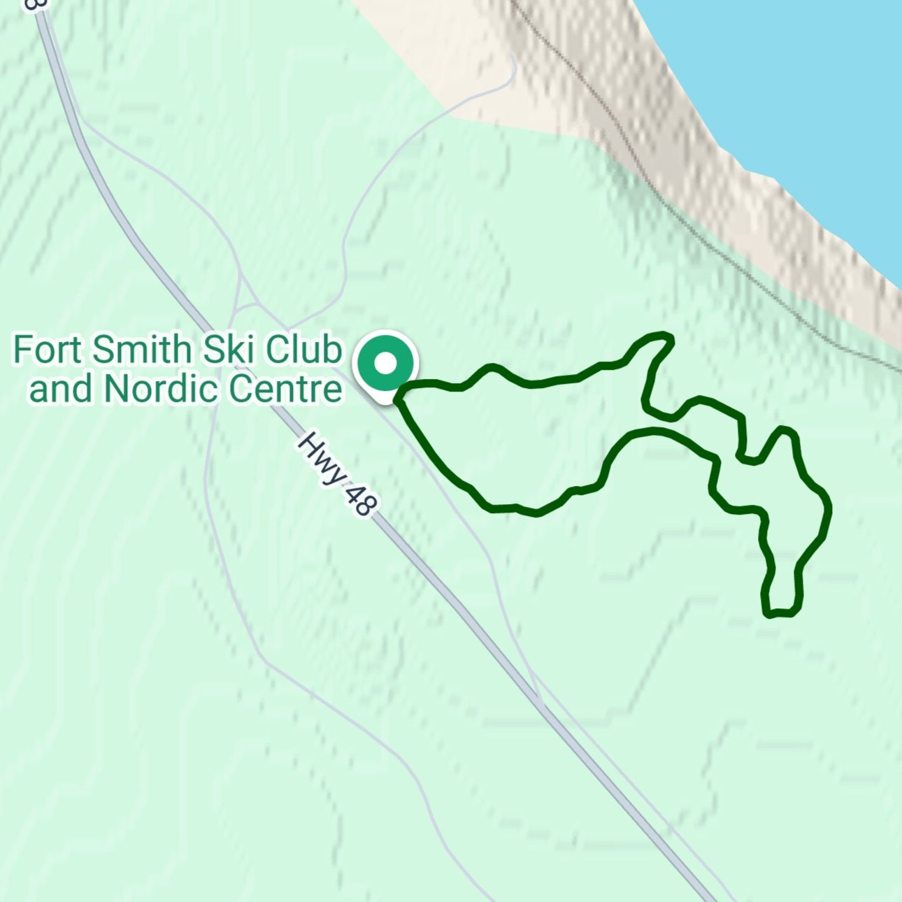
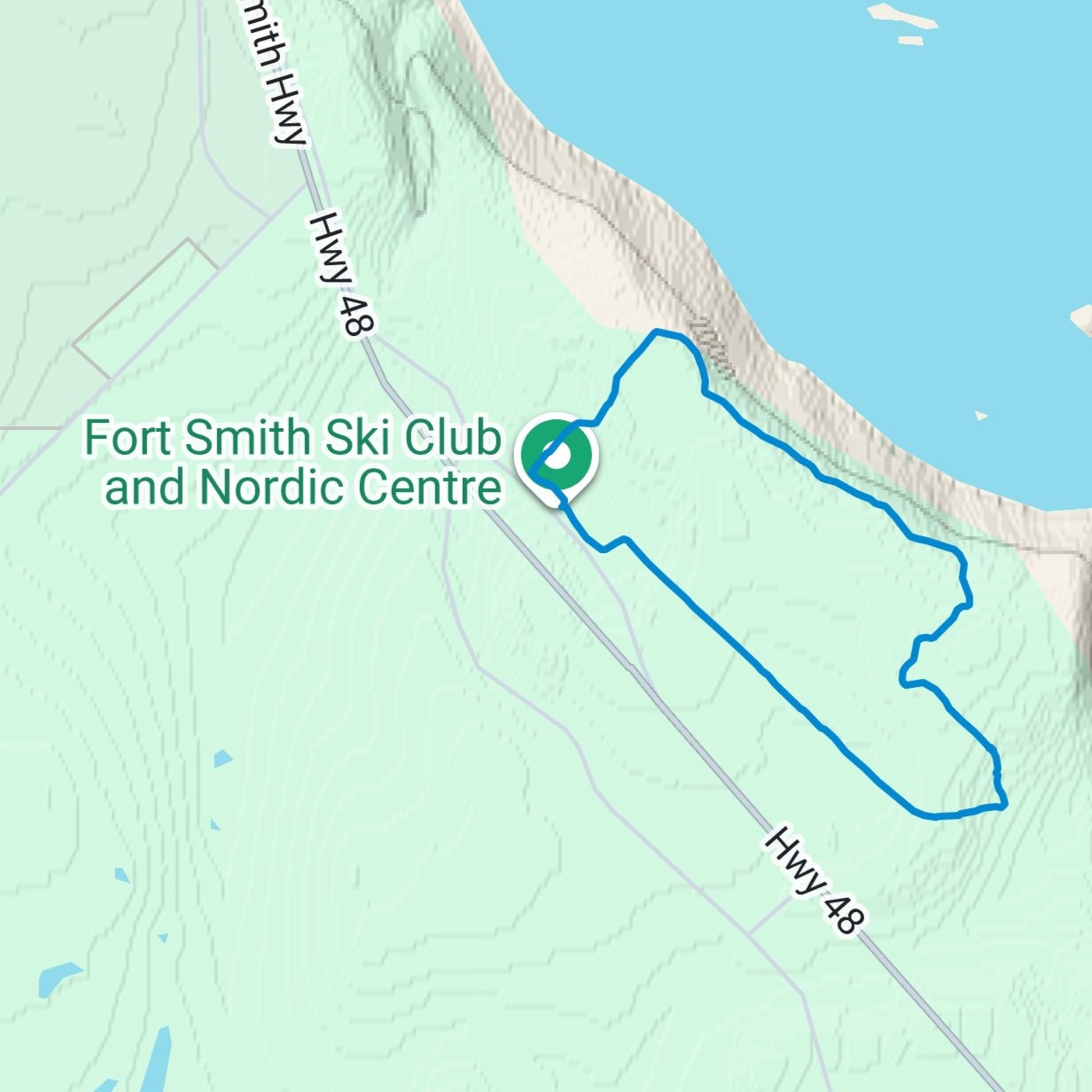
OUR TRAIL NETWORK
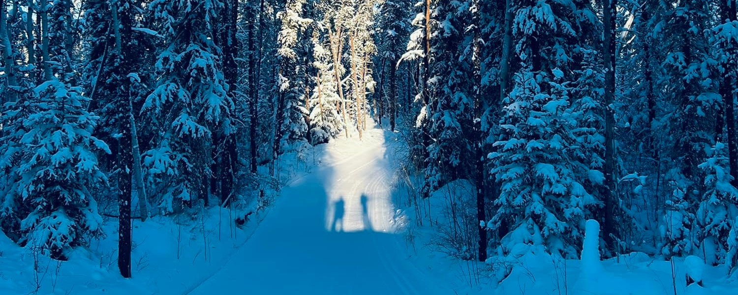
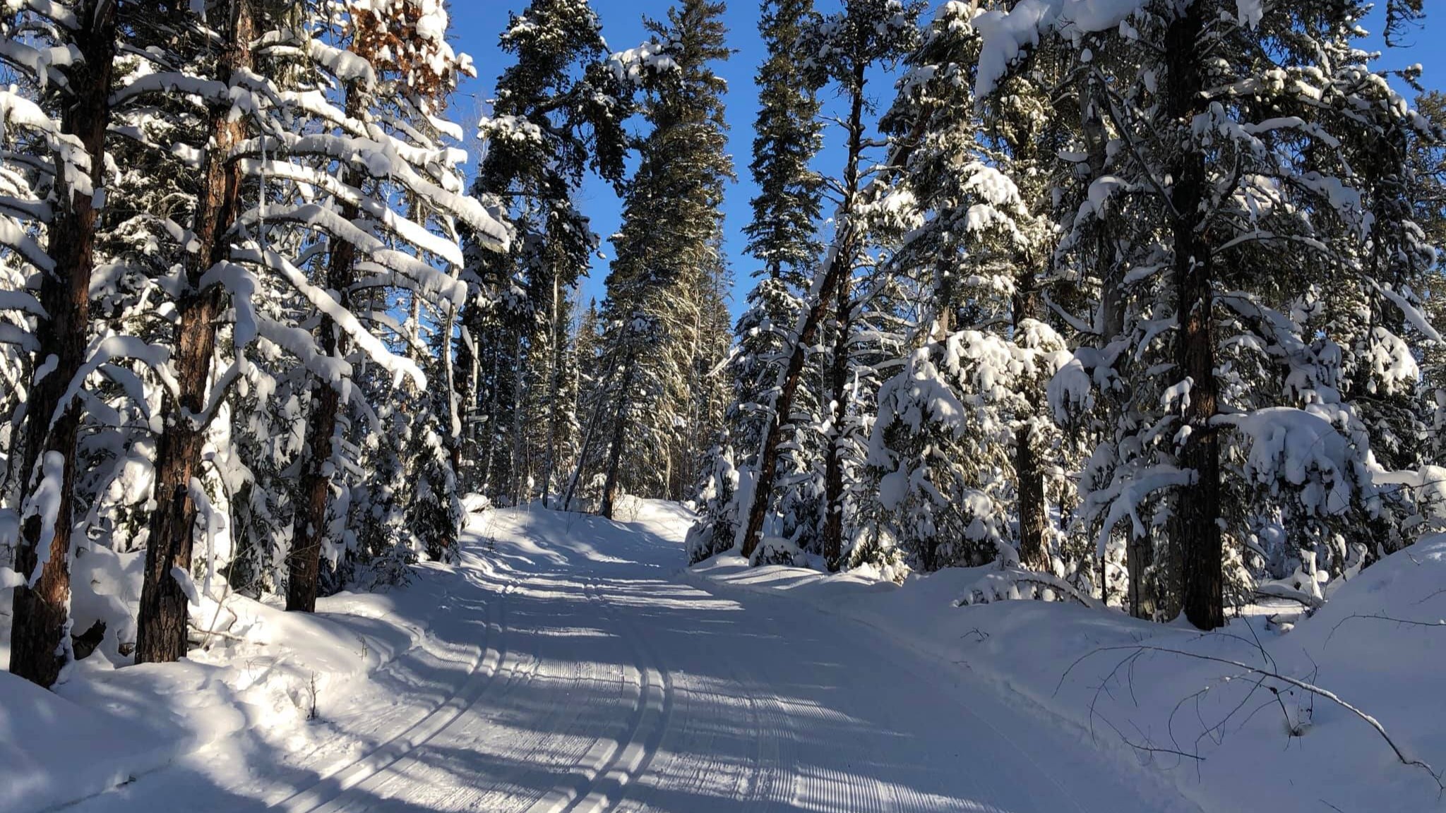
We maintain meticulously groomed trails for classic and skate skiing, offering routes for every ability level—from gentle beginner loops to our most challenging long-distance tours. Discover the stunning Boreal forest, view magnificent Slave River panoramas, and enjoy exceptional skiing under the vast NWT sky.
Click on the tabs below for details about each of the trails. These trails are organized in this chart:
")

Click Image to Enlarge
| Description: | Considered our most accessible route, this gentle loop is ideal for first-time skiers, families, and those returning to the sport. It features minimal elevation changes and wide turns, ensuring a confident glide. As an added benefit, this loop is fully illuminated for safe and enjoyable night skiing, and it serves as the perfect low-impact warm-up for more experienced skiers. |
| Difficulty: | 🟢 Easy |
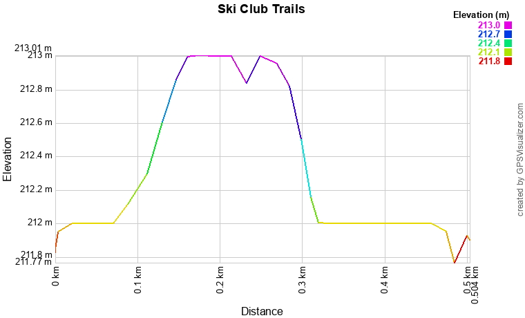
| Distance: | 0.5km |
| Link to Map: | Click Here |

Click Image to Enlarge
| Description: | A perfect route for building fitness and confidence! This 1km loop is categorized as easy and is excellent for beginners and families. While mostly gentle, it features a smooth 19m elevation gain over its length—just enough to practice fundamental hill techniques before tackling longer trails. Use it for a focused workout, a quick classic ski, or enjoy a brief Boreal adventure. |
| Difficulty: | 🟢 Easy |
| Distance: | 1.0km |
| Link to Map: | Click Here |
| Trail Profile PDF: | Click Here |

Click Image to Enlarge
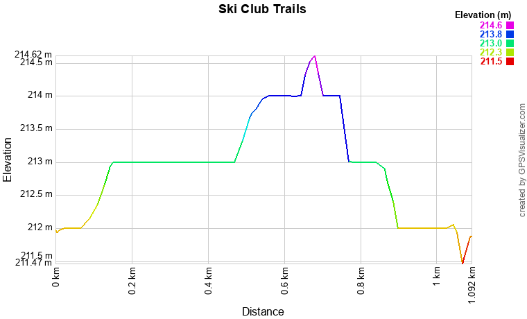
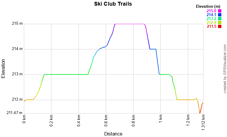
| Description: | This vital 1.25km route serves as a convenient shortcut, effectively dividing the longer 2.5km loop in half. While the full 2.5km loop presents a moderate challenge with its 46m total elevation change, this section-connector is perfect for those who want an easier, shorter, focused ski. Use this intermediate shortcut to bail out early if needed, or to complete targeted training intervals without committing to the full moderate-difficulty distance. |
| Difficulty: | 🟢 Easy |
| Distance: | 1.25km |
| Link to Map: | Click Here |
| Trail Profile PDF: | Click Here |

Click Image to Enlarge
| Description: | This scenic 1.5km loop offers a delightful ski with a minimal elevation gain of only 7m. Named for its proximity to the Pelican Rapids Golf Course, the trail glides along the perimeter of the course grounds, offering open views and fabulous river views. This route is known for its easy, relaxing pace. Historically, this loop was significantly longer and featured the infamous "Truicide" hill, but the current configuration is now a cherished, gentle track perfect for unwinding after work or enjoying a stress-free family ski. |
| Difficulty: | 🟢 Easy |
| Distance: | 1.5km |
| Link to Map: | Click Here |
Click Image to Enlarge
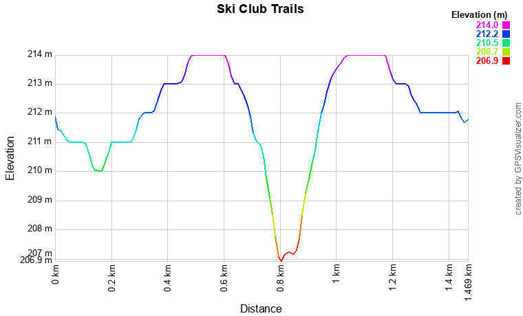
| Description: | This popular 2.5km route is designed to test your intermediate skills. This trail is classified as moderately challenging, featuring a notable total of 46m of elevation gain that includes both sustained climbs and exciting downhill runs. Skiers should be prepared for several challenging sections, including one particular descent that demands focused control due to a technical turn located immediately at the base of the hill. It’s the perfect loop for a vigorous workout and refining your speed and cornering technique. |
| Difficulty: | 🟠 Moderate |
| Distance: | 2.5km |
| Link to Map: | Click Here |
| Trail Profile PDF: | Click Here |

Click Image to Enlarge
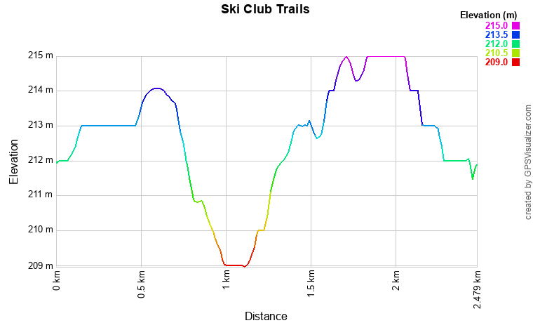
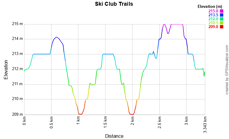
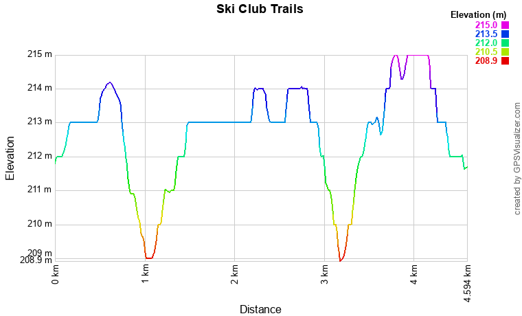
| Description: | Designed for the dedicated skier, the 3.3km loop offers a significant step up in difficulty, earning its rating as a challenging route. Skiers must navigate multiple demanding hills and conquer a total of 65m of elevation gain. This loop is a fantastic training route, as it expertly integrates all of the challenging terrain found on the 2.5km loop while also covering crucial sections of the 4.6km loop. Use this distance to test your stamina and refine your technique on sustained climbs and steep descents. |
| Difficulty: | 🟠 Moderate |
| Distance: | 3.3km |
| Link to Map: | Click Here |
| Trail Profile PDF: | Click Here |
Click Image to Enlarge
| Description: | The Woodpecker Trail Loop is a delightful 4.3km journey classified as one of our easier trails, making it ideal for a relaxing tour. With a gentle 46m of total elevation gain, the route is manageable for most skiers. This loop is a favourite for those who value nature immersion, as it weaves through a narrow, meandering path deep within the Boreal forest. There are a few moderate hills, but the views of the Slave River are well worth the effort. It's the perfect route to slow your pace, take in the serene views, and enjoy a quiet, engaging ski experience. |
| Difficulty: | 🟢 Easy |
| Distance: | 4.3km |
| Link to Map: | Click Here |
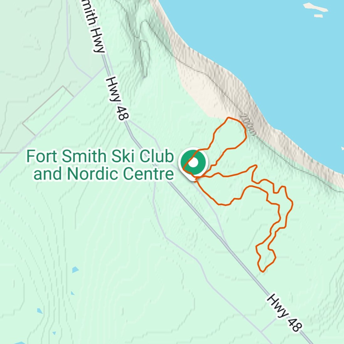
Click Image to Enlarge
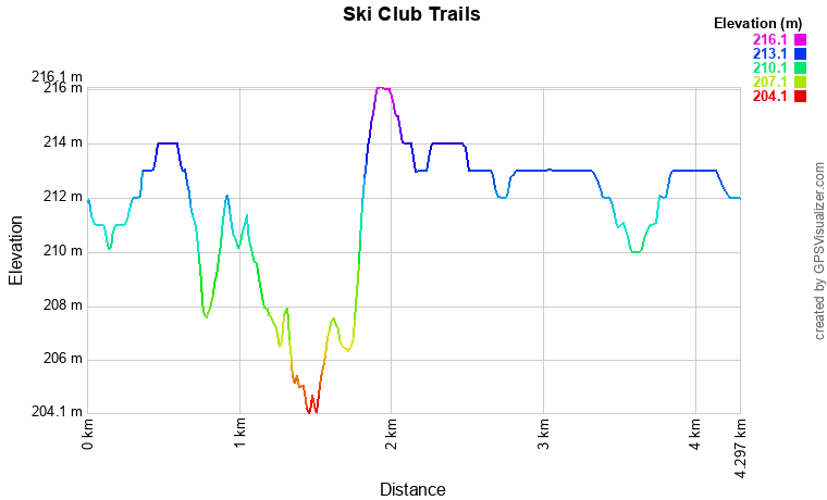
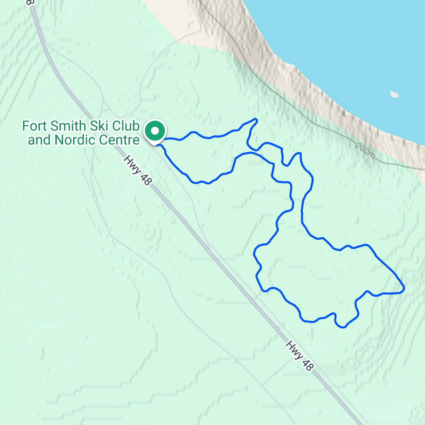
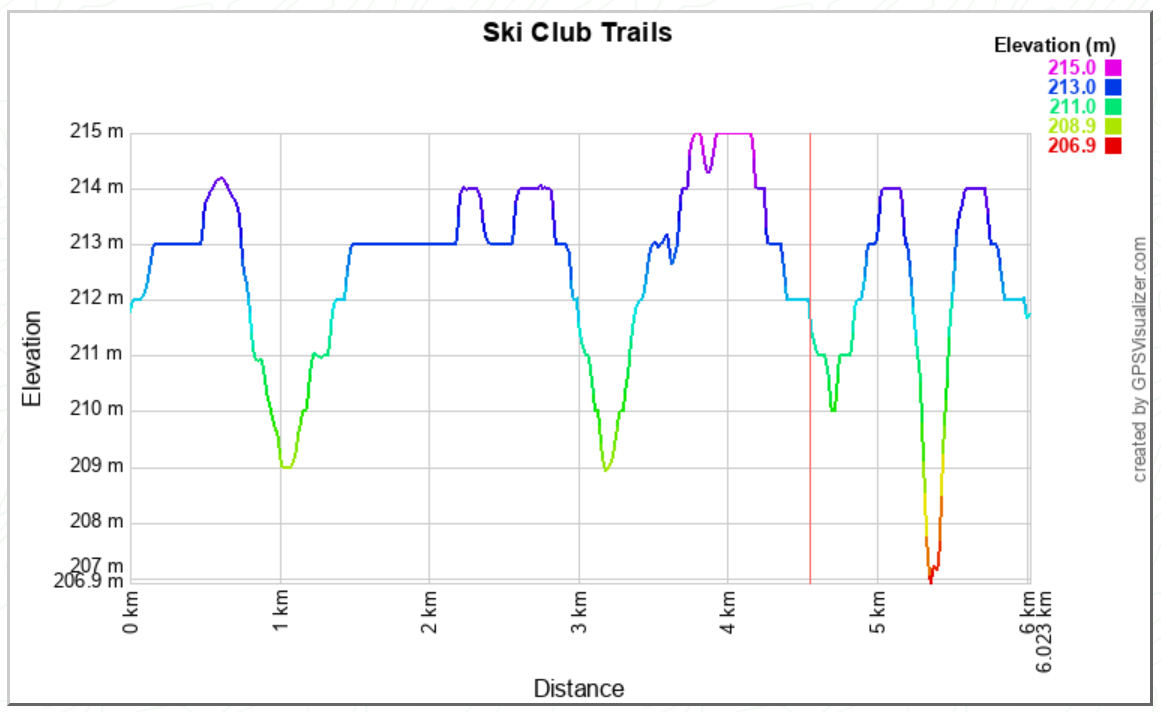
| Description: | The 4.6km Club Challenge is our most comprehensive and demanding loop, providing the ultimate tour of the Fort Smith Ski Club's trail network. It features a formidable 65m elevation gain and incorporates all the challenging climbs and technical descents found on both the 2.5km and 3.3km routes, plus an additional 1.5km of vigorous terrain. Skiing this route requires stamina and technical skill, making it the premier choice for serious training, long-distance workouts, and enjoying the full scope of our expertly groomed trails. |
| Difficulty: | 🟠 Moderate |
| Distance: | 4.6km |
| Link to Map: | Click Here |
| Trail Profile PDF: | Click Here (Note: This PDF covers more than the 4.6km loop) |
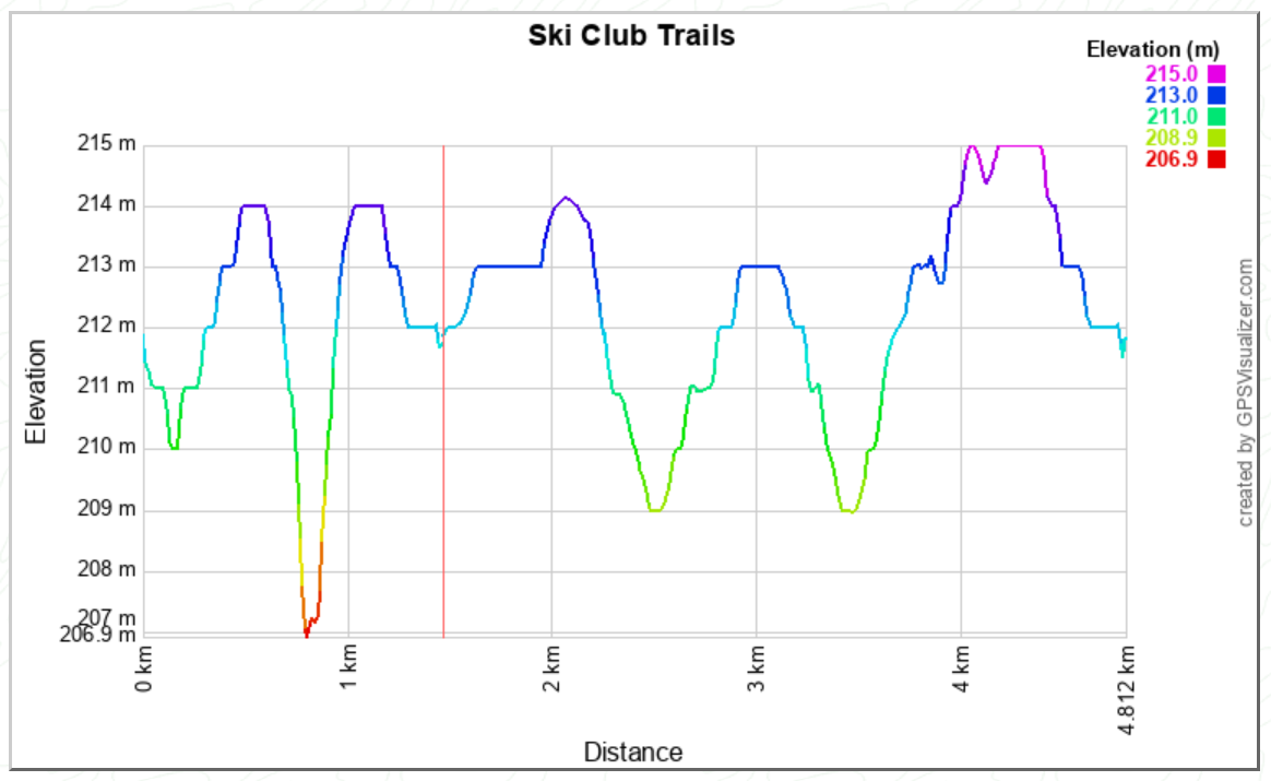
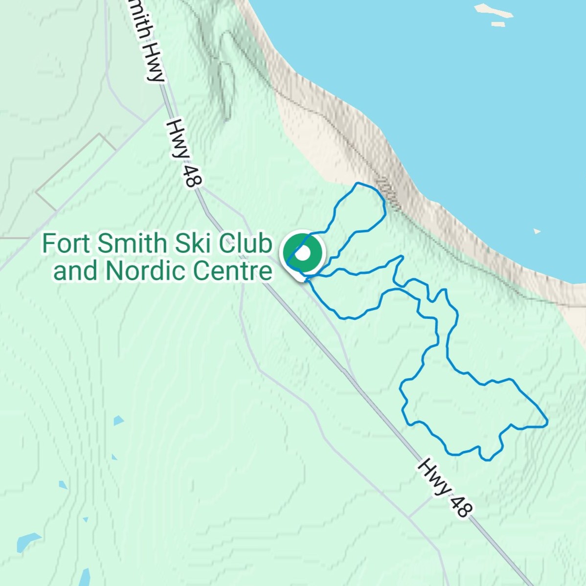
Click Image to Enlarge
| Description: | The 4.8km Challenge & Glide provides a dynamic skiing experience that merges two very different parts of our trail network. It starts with the demanding 3.3km loop, incorporating the majority of its challenging hills and 65m elevation gain for a vigorous workout. Once the difficult climbs are complete, the route connects directly into the easy, scenic 1.5km Golf Course Loop, offering a high-speed, relaxing finish along the course perimeter. This route is ideal for skiers who want a balanced tour of both our strenuous and gentle terrain. |
| Difficulty: | 🟠 Moderate |
| Distance: | 4.8km |
| Link to Map: | Click Here |
| Trail Profile PDF: | Click Here (Note: This PDF also covers Truicide Hill) |
Click Image to Enlarge
| Description: | The 6.0km Full Perimeter Tour is the longest single loop on the Fort Smith Ski Club main network, offering the definitive endurance challenge. This route incorporates the entire demanding 4.6km Club Challenge (with all its intense 65m elevation gain and technical hills) and extends it to include the smooth, relaxing terrain of the 1.5km Golf Course Loop. Ideal for marathon training and those seeking a complete tour, this loop provides a continuous, high-effort workout followed by a scenic, gentle cool-down on the course perimeter. |
| Difficulty: | 🟠 Moderate |
| Distance: | 6.0km |
| Link to Map: | Click Here |
| Trail Profile PDF: | Click Here (Note: This PDF only covers part of this trail) |
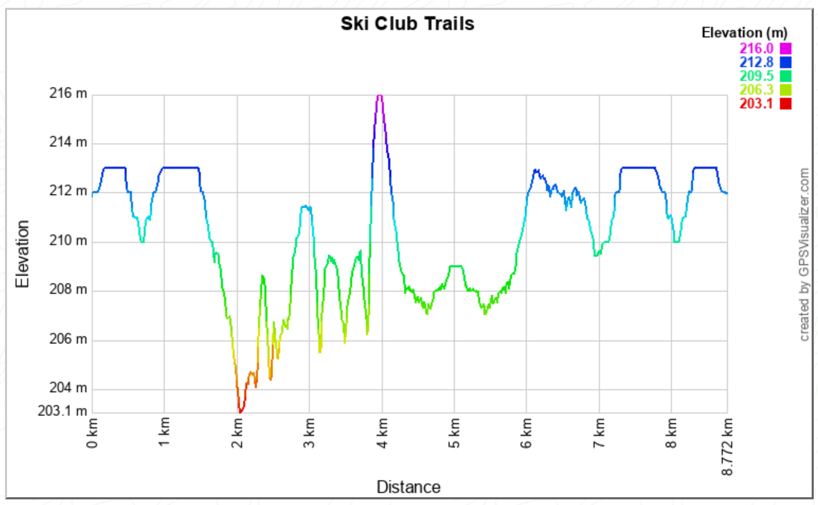
Click Image to Enlarge
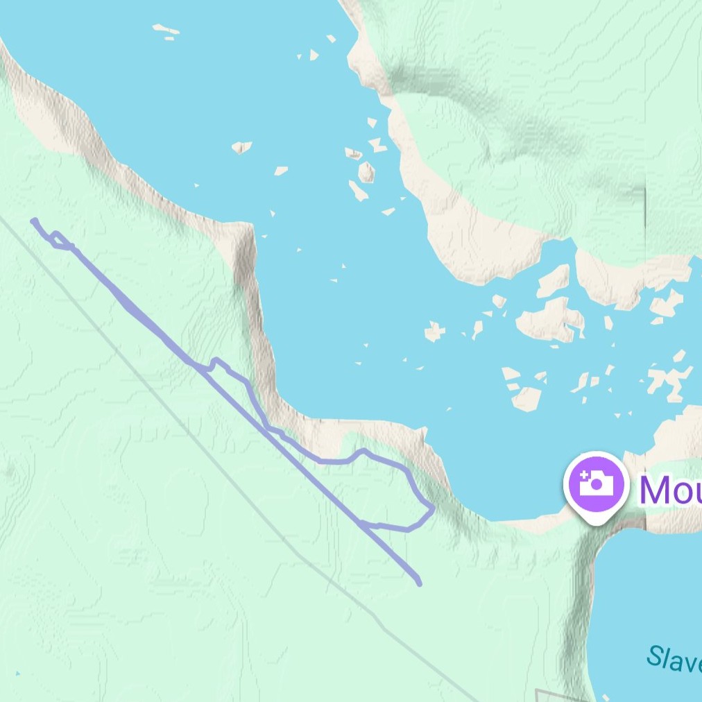
| Description: | Embrace the wilderness on the 8.8km Mountain Portage Loop, our longest and most adventurous route. Setting out from the Nordic Centre, this trail follows the breathtaking top of the Slave River bank, offering spectacular, panoramic views looking down over the historic river rapids. The loop leaves the immediate club grounds to reach the scenic Mountain Portage turnaround point. While the second half requires backtracking along the same thrilling riverbank path, this route is the ultimate long-distance tour, rewarding the dedicated skier with Fort Smith's most unforgettable scenery. |
| Difficulty: | 🟠 Moderate |
| Distance: | 8.8km |
| Link to Map: | Click Here |
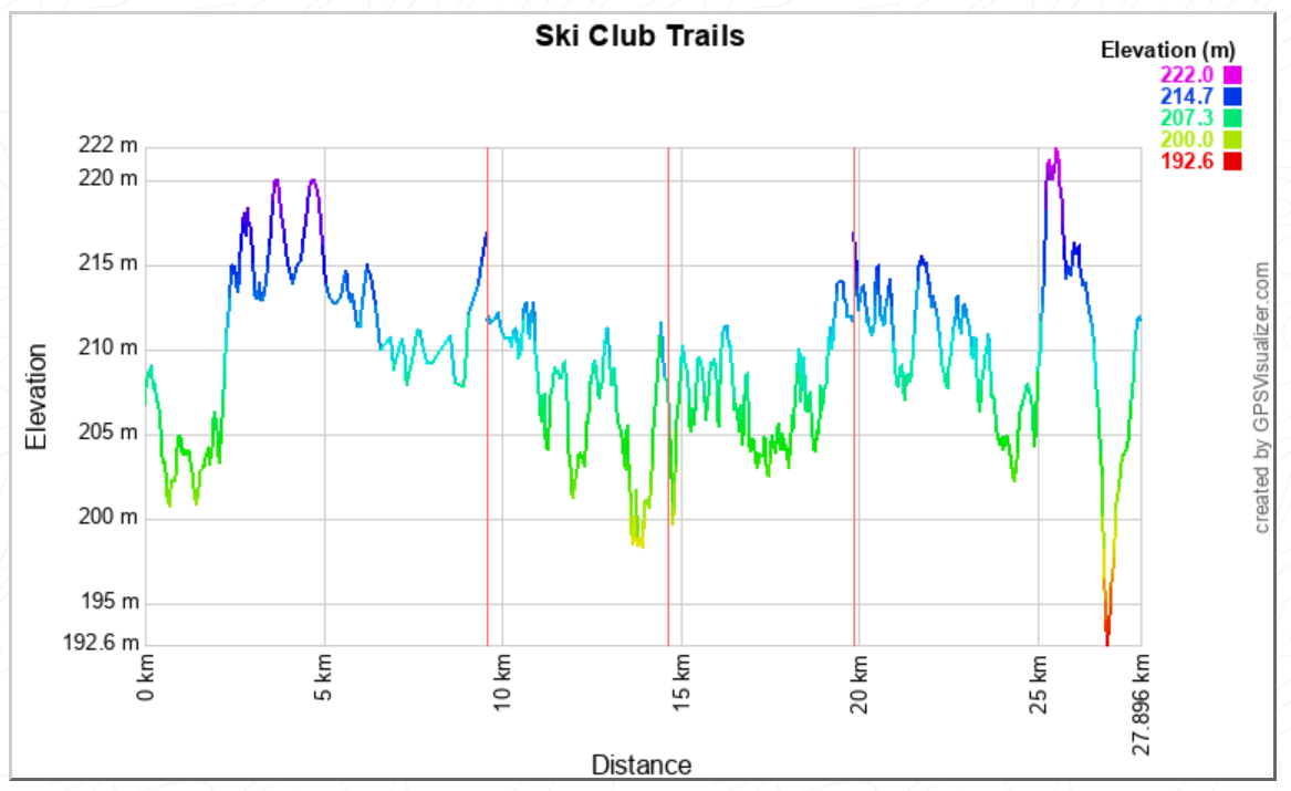
Click Image to Enlarge
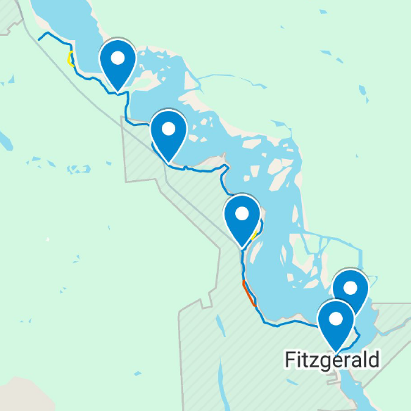
| Description: | The Thebacha Loppet is more than a trail; it is a historic journey along the DesNethé Discovery Trail. This route, which officially began as a ski tour in 1973, follows a traditional First Nations portage route that bypassed the unnavigable rapids of the Slave River, connecting Fort Fitzgerald, AB, to Fort Smith, NWT. Starting in Fitzgerald, the trail winds through the boreal forest, offering incredible views as it hugs the shores of the Mighty Slave River. The route is only groomed for the Thebacha Loppet and includes a variety of terrain. The final segment integrates seamlessly with the club's local trails, linking up with parts of the Mountain Loop and the Woodpecker Trail before finishing triumphantly at the Nordic Centre. While used primarily for the annual race, this scenic, challenging route provides an unparalleled long-distance, ungroomed ski experience. It is broken down into four checkpoint segments for those wishing to ski shorter, multi-stage portions. |
| Difficulty: | 🟠 Moderate |
| Distance: | 27.6km |
| Link to Map: | Click Here |